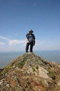
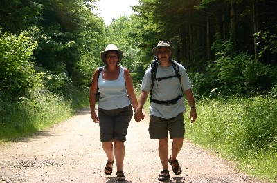
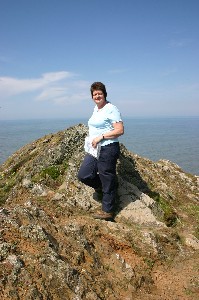
Mo and Dave walk the Pennine Way for

Cancer Research UK


If you would like to support Mo and Dave's charity walk please visit http://www.justgiving.com/pen9way


Latest fundraising total is £4023.51


Our walk is now complete please click here to visit our Photo Gallery pages
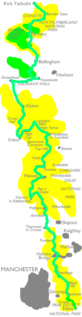
 

The Pennine Way is Britain's first and best known National Trail, and stretches for roughly 270 miles and a total of 39,500 foot of ascent and descent from the Derbyshire Peak District to the Scottish Borders.
We will be walking the route from south to north, from Edale (south of Manchester) to Kirk Yetholm in Scotland.
The trek commences with the peat groughs of Kinder and Bleaklow followed by the wild moorland of the Bronte country around Haworth, before reaching the superb limestone scenery of the Yorkshire Dales. Streams disappear underground, and potholes abound as the walk passes Malham Tarn and Cove, and makes the ascent of Pen-y- Ghent before descending to Horton -in-Ribblesdale. From here good tracks lead over the moors to the old market town of Hawes in Wensleydale. Great Shunner Fell is climbed on the way to the old lead-mining area of Swaledale, and via Keld village, upwards again towards the highest inn in England, at Tan Hill. At 1732 feet above sea-level, this was once an important meeting place of trade routes, and the haunt of local coal miners. The Way continues via Baldersdale and the Balderhead dam to Middleton in Teesdale, thence via Langdon Beck and Englands highest waterfall at High Force, to Cauldron Snout and High Cup Nick, before descending into the pretty red sandstone village of Dufton, nestling on the western side of the Pennine chain. From Dufton the route continues eastwards over Cross Fell, the highest point of the walk, then on through the Northumberland National Park towards the northernmost section of the Roman Empire defined by Hadrians Wall, its milecastles and forts being of great historical interest. The long trek through the Keilder Forest area and thence along the ridge of the Cheviot Hills and over the Scottish border to Kirk Yetholm completes the 270 mile walk of the Pennine Way.

We will be setting off on our incredible 270 mile adventure on Friday May 26th and will be arriving at Kirk Yetholm just over 3 weeks later. The map on the left of this page will be updated each day of our journey to illustrate our progress. We will also be sending a daily diary to this site (see below) so you all can keep in touch with how we are fairing and share in our highs and lows.

If you are interested in the equipment that we are using for our walk please visit our KIT PAGE.

Now for the important bit, most of us have been touched by Cancer in one way or another, be it a relation, friend, or neighbour so we will be walking the 270 mile Pennine Way to raise money for Cancer Research.100% of your fundraising donations go direct to Cancer Research UK , we will be financing this once in a lifetime trip ourselves.

Donating through our fundraising site is simple, fast and totally secure. It is also the most efficient way to sponsor us: Cancer Research UK will receive your money faster and, if you are a UK taxpayer, an extra 28% in tax will be added to your gift at no cost to you.

We will do the walking you just click here to "SPONSOR US NOW"   and please come back regularly to keep up with the news on our Daily Diary.

Thanks again for your support and we are sure that your kind thoughts will be with us all the way and help us when undoubtedly times will get tough out on those bleak moors and hills that stretch along the backbone of England from south of Manchester all the way to Scotland. Please try and pass on the website to as many people as you can and hopefully with your help we will reach our target of £5,000 for Cancer Research by the time we arrive in Kirk Yetholm on the 18th June.


Cheers for now

Mo & Dave

READ OUR SUPPORT MESSAGES HERE


 Mo and Dave's Daily Diary


If you have any problems with this website please report them to davebridgwater@btconnect.com


Mo and Dave's walk has now been completed, please click on the daily diary links below to read their adventures:-

           
CLICK ON DAY

DATE

ROUTE PLANNED

DISTANCE PLANNED (Miles)
 Day One

Fri  26th May 06

Edale to Torside Reservoir 15
 Day Two

Sat 27th May 06

Torside Reservoir to Marsden 12
 Day Three 

Sun 28th May 06

Marsden to Mankinholes 14
 Day Four

Mon 29th May 06

Mankinholes to Ponden Stanbury 13
 Day Five

Tues 30th May 06

Stanbury to East Marton 15
 Day Six

Wed 31st May 06

East Marton to Malham 9
 Day Seven

Thurs 1st June 06

Malham – rest day 0
 Day Eight

Fri 2nd June 06

Malham to Horton in Ribblesdale 16
 Day Nine

Sat 3rd June 06

Horton in Ribblesdale to Hawes 15.5
 Day Ten

Sun 4th June 06

Hawes – rest day 0
 Day Eleven

Mon 5th June 06

Hawes to Tan Hill 16.5
 Day Twelve

Tues 6th June 06

Tan Hill to Baldersdale – approx half way 11
 Day Thirteen

Wed 7th June 06

Baldersdale to Langdon Beck 15.5
 Day Fourteen

Thurs 8th June 06

Langdon Beck to Dufton 13.5
 Day Fifteen

Fri 9th June 06

Dufton – rest day 0
 Day Sixteen

Sat 10th June 06 

Dufton to Garrigill 16
 Day Seventeen

Sun 11th June 06 

Garrigill to Slaggyford 9
 Day Eighteen

Mon 12th June 06

Slaggyford to Greenhead 11
 Day Nineteen

Tues 13th June 06 

Greenhead to Housesteads 10
 Day Twenty

Wed 14th June 06

Housesteads – rest day 0
 Day Twenty One

Thurs 15th June 06

Housesteads to Bellingham   14.5
 Day Twenty Two

Fri 16th June06

Bellingham to Byrness 15.5
 Day Twenty Three

Sat 17th June 06 

Byrness to Cocklawfoot 17
 Day Twenty Four

Sun 18th June 06

Cocklawfoot to Kirk Yetholm

14

       
Click here to read our support messages